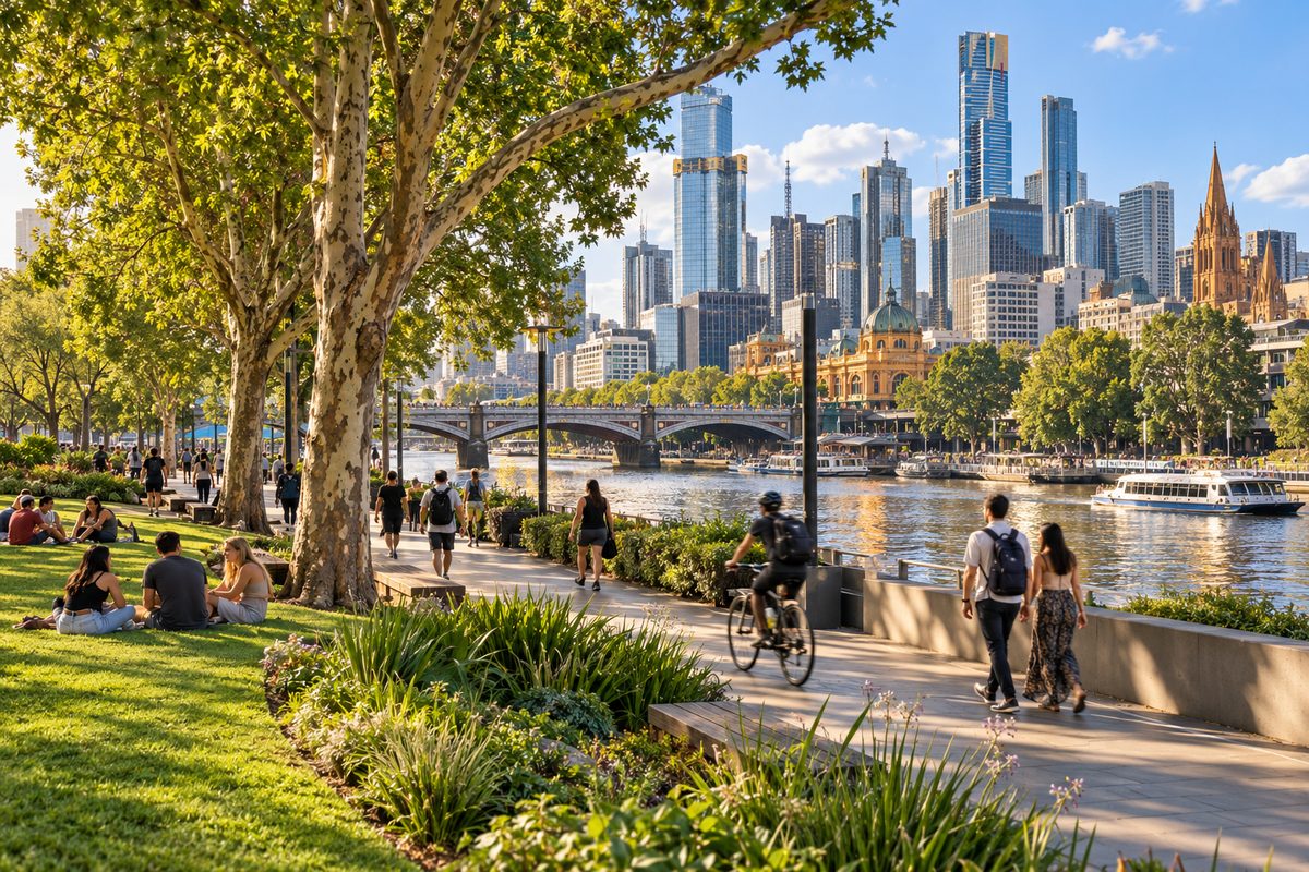
Southbank Melbourne Parks and Green Spaces
Southbank has almost no park land inside its own boundary, yet it sits within a ten minute walk of more than 100 hectares of public gardens. That is the fact to hold onto. Southbank, Victoria is one of the most densely built suburbs in Australia. Apartment towers, the casino and the Melbourne Arts Precinct take up most of the ground. The green space people picture when they think of this part of the city belongs to the suburbs next door. Kings Domain, Queen Victoria Gardens and Alexandra Gardens, Melbourne sit just across St Kilda Road. Birrarung Marr, Melbourne is one footbridge away over the Yarra River. Albert Park, Victoria starts two kilometres to the south. If you live, work or stay in Southbank, the useful question is not which park is in the suburb. It is which park is closest to where you are standing, and what it is good for.
This guide from Southbank by the River maps the urban green space around Southbank by distance and purpose, so you can pick the right lawn for a lunch break, a quiet hour or a full day.
Why does Southbank have so little park of its own?
Southbank was industrial land until the 1980s. Factories, warehouses and rail yards filled the south bank of the Yarra River. When the City of Melbourne and the state rebuilt the area, the plan put the arts, the casino and the exhibition centre on the river and left residential towers behind them. Parks were not part of the first wave. The suburb grew to more than 20,000 residents before anyone built a proper neighbourhood park.
The result is a suburb with wide footpaths, a long river promenade and a lot of hard paving. Southbank Promenade is the best known public space here, and it has almost no grass. Queensbridge Square is a plaza, not a park. This matters because many visitors arrive expecting a riverside garden on the Southbank side. The gardens are there, but they start where Southbank ends.
The City of Melbourne has worked on this gap for the past decade. The council turned traffic lanes on Southbank Boulevard and Dodds Street into linear parkland, adding lawn, trees and seating where cars once ran. It also opened a small park beside the Boyd Community Hub on City Road. These projects added real green space to the suburb for the first time. They are still small compared with the gardens across the road.
Which green spaces sit inside Southbank itself?
Three places count as genuine green space within the suburb boundary.
- Southbank Boulevard parkland. This runs from St Kilda Road toward the river along the northern side of the Melbourne Arts Precinct. Expect new lawn, young trees, playground elements and plenty of benches. It is the closest grass to Arts Centre Melbourne and the Melbourne Recital Centre. Shade is still thin because the trees are young.
- Boyd Park. A pocket park on City Road next to the Boyd Community Hub and library. It has a lawn, a playground and a water play area. It serves residents more than visitors, and it is the best spot in the suburb for small children.
- Dodds Street. The council closed this street to through traffic and planted it as a shared garden lane between the Victorian College of the Arts buildings. It is quiet, green and often empty on weekends.
These three cover most of what Southbank offers. They are good for a short sit or a coffee on the grass. For anything longer, cross St Kilda Road or the river.
Where is the nearest big lawn when you want to sit down?
Queen Victoria Gardens. It sits directly across St Kilda Road from Arts Centre Melbourne and takes about three minutes to reach from the spire. The gardens cover almost five hectares and hold the floral clock, the Queen Victoria memorial and a wide lawn that slopes toward the river.
This is the park most Southbank workers use at lunch. The lawn under the elms near the floral clock fills first on sunny days. The lower section near Alexandra Avenue stays quieter. The gardens open from dawn and have no gates, so early morning and late evening visits are easy.
Alexandra Gardens, Melbourne is the next option, and it serves a different need. It runs along the south bank of the Yarra River east of Princes Bridge. The riverside path here is flat and wide, which makes it the main route for cyclists and runners heading toward Richmond. The Riverslide Skate Park sits at the western end. The rowing sheds along Boathouse Drive line the water. Alexandra Gardens is less a garden for sitting in and more a green corridor for moving through. If you want to watch rowers on the water or eat lunch with a river view, it beats Queen Victoria Gardens. If you want shade and quiet, pick Queen Victoria Gardens.
How do you reach Birrarung Marr from the Southbank side?
Walk east along Southbank Promenade to Princes Bridge, cross to the north bank and continue east past Federation Square. The whole trip from the Arts Centre takes about ten minutes. You can also use the Sandridge Bridge or the Evan Walker footbridge further west, then walk along the north bank. Both routes avoid traffic entirely.
Birrarung Marr, Melbourne is the newest large park in the Melbourne central business district. It opened in 2002 on former rail land and covers about eight hectares along the north bank of the river. The name comes from the Woiwurrung language and means the river of mists and the side of the river. The park is laid out in three terraces that step down from Flinders Street toward the water. The upper terrace holds the Federation Bells, a set of 39 bells that play at set times through the day. The lower terrace meets the river path.
Birrarung Marr works best for two things. It is the main event lawn for the city, so it hosts festivals, markets and outdoor concerts through the year. On event days it is crowded and partly fenced. On ordinary days it is one of the emptiest open spaces this close to the centre. The slope gives a clear view back across the Yarra River to the Southbank towers, which is why photographers use it at dusk. ArtPlay, the children's art centre, sits at the western edge and runs weekend programs for kids.
The practical point for Southbank residents is simple. Birrarung Marr is your closest large park on the north bank, and it is often quieter than anything on the south side at the weekend.
When is Kings Domain the better choice?
When you have more than an hour and want to feel away from the city. Kings Domain covers about 36 hectares between St Kilda Road and the Royal Botanic Gardens. It is the largest single park within walking distance of Southbank, and the most varied.
The Shrine of Remembrance stands at the southern end on a rise above St Kilda Road. The walk up the forecourt steps gives one of the best free views of the Melbourne central business district. The Shrine itself is open daily and free to enter. The balcony at the top is worth the climb. The lawns around the Shrine are formal and open, with little shade.
North of the Shrine, Kings Domain becomes a true parkland. The Sidney Myer Music Bowl sits in a natural hollow and hosts free concerts in summer. Government House rises behind a tree line to the east. The paths between them wind under mature elms and oaks that date from the nineteenth century. This is where the shade is. On a hot afternoon, the lawns around the Music Bowl stay cool when Queen Victoria Gardens does not.
Kings Domain also connects directly to the Royal Botanic Gardens Victoria. The Botanic Gardens are free, open daily and cover another 38 hectares. Together, the Domain and the Botanic Gardens form a continuous green belt from St Kilda Road to the river at Anderson Street. You can walk from Arts Centre Melbourne to the Botanic Gardens' Observatory Gate in about fifteen minutes without crossing more than two roads.
Is Albert Park worth the extra distance?
Yes, for exercise and for space. Albert Park, Victoria lies about two kilometres south of Southbank, between South Melbourne and St Kilda Road. It covers roughly 225 hectares around a large lake. The lake path runs just under five kilometres and is flat the whole way. It is the standard training loop for runners and cyclists in the inner south, and it is wide enough that walkers and runners do not compete for room.
Albert Park is a different kind of green space from the gardens along St Kilda Road. There are no formal beds or memorials. Instead you get sports fields, a golf course, sailing clubs on the lake and long views across open water. Black swans live on the lake year round. The park also contains the Grand Prix circuit, which means sections close for several weeks each year around the race. Check Parks Victoria for closure dates before planning a visit in that period.
Getting there from Southbank is easy. Tram routes along St Kilda Road stop at the park's eastern edge. From South Melbourne, walk south along Clarendon Street or Moray Street and enter near the Aquatic Centre. On foot from the Arts Centre, allow 25 to 30 minutes. Most Southbank residents who run or cycle regularly end up here because it is the only park nearby with a continuous loop long enough for a proper workout.
Which green space suits which purpose?
The parks around Southbank do different jobs. Choosing by purpose saves time.
- A quick lunch on grass: Queen Victoria Gardens or the Southbank Boulevard parkland. Both are under five minutes from the Arts Centre.
- Shade on a hot day: the northern half of Kings Domain, around the Sidney Myer Music Bowl. The tree canopy there is the densest near Southbank.
- River views: Alexandra Gardens, Melbourne on the south bank, or the lower terrace of Birrarung Marr on the north bank.
- A long walk or run: Albert Park lake loop, or the river path east through Alexandra Gardens toward the Botanic Gardens and beyond.
- Small children: Boyd Park for the playground and water play, or ArtPlay at Birrarung Marr for weekend programs.
- A city view: the Shrine of Remembrance balcony, or the upper terrace at Birrarung Marr at sunset.
- Quiet: Dodds Street on a weekend, or Birrarung Marr on any day without an event.
What is changing in the Melbourne Arts Precinct?
The biggest shift in Southbank green space is still under construction. The Melbourne Arts Precinct Transformation is rebuilding the area between Arts Centre Melbourne and the National Gallery of Victoria on St Kilda Road. The plan includes a new public garden of about 18,000 square metres on the roof and ground level of the precinct, with the Woiwurrung name Laak Boorndap. It will link Southbank Boulevard to the river and to Queen Victoria Gardens across the road.
When finished, this garden will be the first large planted space inside the Southbank boundary. It will sit on top of the new NGV Contemporary and the rebuilt Arts Centre theatres. The state government and Development Victoria publish progress on the official project site. Treat completion dates as estimates until the gates open. For now, parts of Southbank Boulevard and Sturt Street near the precinct are fenced for works, which affects access to the parkland described above.
What do most guides get wrong about Southbank green space?
They treat Southbank Promenade as a park. It is a paved walkway with cafés and no lawn. People who arrive expecting to spread a picnic blanket by the water end up sitting on concrete steps. The grass is 300 metres away across St Kilda Road or over Princes Bridge, and most guides never say so.
They also mix up the gardens along St Kilda Road. Queen Victoria Gardens, Alexandra Gardens and Kings Domain sit side by side and look similar on a map. They are managed as separate parks with different uses. Queen Victoria Gardens is the formal garden. Alexandra Gardens is the river corridor. Kings Domain is the large parkland with the Shrine and the Music Bowl. Knowing which is which saves a confused walk.
A third mistake is leaving out South Melbourne and Albert Park, Victoria. Many Southbank guides stop at the river and the arts precinct. South Melbourne is a ten minute walk from the western end of Southbank, and it is the gateway to the largest park in the inner south. For anyone who runs, cycles or wants real open space, that direction matters more than the river.
Finally, almost every guide confuses this suburb with South Bank in Brisbane, which has a large riverside parkland with a beach and lagoon. Southbank in Melbourne has nothing like that. The green here is borrowed from the neighbouring suburbs, and that is the whole point of planning your visit by distance rather than by suburb name.
How do you plan a green day out from Southbank?
Start at the river and work south. Begin at Southbank Promenade for coffee, cross St Kilda Road to Queen Victoria Gardens, walk through Kings Domain to the Shrine of Remembrance, then continue into the Royal Botanic Gardens. That route covers about three kilometres on foot and passes through four distinct green spaces without leaving the garden belt. Exit the Botanic Gardens at Anderson Street and follow the river path back west through Alexandra Gardens to Princes Bridge. The loop takes two to three hours at a relaxed pace.
For a shorter version, cross Princes Bridge to Birrarung Marr, walk the three terraces, then return along the north bank and recross at the Evan Walker Bridge. That takes under an hour and gives you the best views of Southbank from outside it.
For an exercise day, take the tram or walk through South Melbourne to Albert Park, do the lake loop, and come back along St Kilda Road past the Shrine. Allow half a day.
Your next steps
- Decide what you want the green space for before you leave. Lunch, shade, a run or a view each point to a different park.
- If you are at the Arts Centre or anywhere along St Kilda Road, cross to Queen Victoria Gardens first. It is the closest proper lawn.
- If you have an hour or more, walk through Kings Domain to the Shrine of Remembrance and into the Botanic Gardens.
- If you want to run or cycle, head through South Melbourne to Albert Park and do the lake loop.
- Check the Melbourne Arts Precinct Transformation site before visiting Southbank Boulevard, as works may close sections of the parkland.
For more on getting around the suburb, including where to eat before or after a walk, see the rest of Southbank by the River.