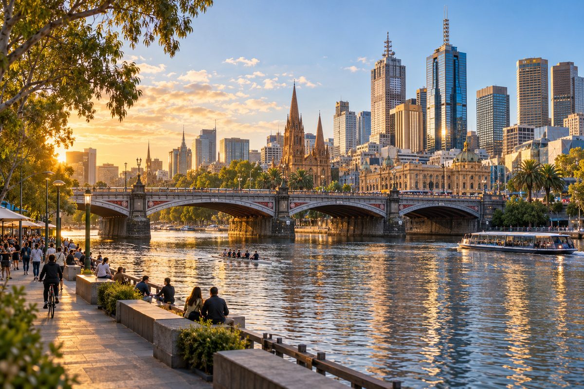
Southbank Melbourne River Bridges Guide
The bridge you choose in Southbank should match where you are going, because each Yarra River crossing lands you in a different part of the city. Princes Bridge suits the arts precinct and Flinders Street railway station. Evan Walker Bridge and Sandridge Bridge are the quickest foot links between the Southgate area and the Melbourne central business district. Seafarers Bridge takes you from the convention end towards Docklands, Victoria. If you know your end point, you pick the right bridge and save yourself a walk back along the bank.
This guide from Southbank by the River works through the main crossings from east to west. It covers what each bridge connects, who it suits, and what most visitors miss about it. Opening hours, works and closures change, so check the City of Melbourne website before you plan around a specific crossing.
Why does the bridge you pick matter so much?
The Yarra River splits Southbank, Victoria from the city grid. Southbank sits on the south side. The CBD sits on the north side. The bridges are the only way across on foot, and they are spread out.
The gaps between them are what catch people out. Walking the full stretch from Seafarers Bridge in the west to Princes Bridge in the east is about two kilometres along the promenade. That is around 25 to 30 minutes at an easy pace. If you cross at the wrong point, you can add 15 minutes before you reach your train or tram.
Here is the simple rule. Look at the street you need on the north side, then find the bridge that lines up with it. The bridges line up with city streets far better than most maps make clear.
- Swanston Street and Flinders Street railway station: Princes Bridge
- The western end of Flinders Street station and Degraves Street area: Evan Walker Bridge
- Elizabeth Street and Market Street: Sandridge Bridge
- Queen Street and William Street: Queens Bridge
- Docklands and the far west of the CBD: Seafarers Bridge
When is Evan Walker Bridge the better choice?
Evan Walker Bridge is the better choice when you are starting from Southgate and want the city fast without crossing traffic. It is a pedestrian footbridge that runs from the Southgate end of the promenade to the north bank, close to the western side of Flinders Street railway station.
The bridge is named after Evan Walker, the Victorian planning minister linked to the redevelopment that turned Southbank from an industrial area into the riverfront it is now. That history matters for one reason. This bridge was built to tie the new Southbank to the city, so it sits right where people actually want to cross.
Why do locals lean on it?
It has no cars, no trams and no traffic lights. You walk from the riverfront restaurants straight onto the north bank. For anyone leaving a meal at Southgate to catch a train, it is often faster than walking east to Princes Bridge. It is also the easier option with a pram or a wheelchair when Princes Bridge footpaths are packed after an event at Hamer Hall, Melbourne.
How does Queens Bridge connect Crown Melbourne to the city?
Queens Bridge is the road bridge at the Crown Melbourne end of Southbank. It opened in 1889 and joins Queensbridge Street on the south side to Market Street and William Street on the north side. If you are leaving Crown Melbourne and need the western half of the CBD, this is your bridge.
It carries traffic and trams, so it is busier and noisier than the footbridges. The upside is that it drops you straight into the business end of the city with tram stops close by. For office workers at the western edge of the CBD, it is the most direct route home from a Southbank dinner.
Where does Seafarers Bridge take you?
Seafarers Bridge is the western crossing. It runs from the area beside the Melbourne Convention and Exhibition Centre to the north bank, giving a walking link towards Docklands, Victoria. It is a pedestrian and cycling bridge with a curved arch that stands out from the older bridges to the east.
The name nods to the area's port history. Nearby you will find the historic Mission to Seafarers building on the north bank and the old wharf sheds along South Wharf. Ships once tied up along this stretch, and it still feels more open and working-class than the arts end.
Who needs Seafarers Bridge?
Conference visitors use it most. If you are staying in Docklands or near Southern Cross Station and attending an event at the convention centre, this bridge cuts out a long loop. It is also the quiet bridge. Even on busy weekends, it rarely gets the crowds you see at Princes Bridge.
Which bridges are best for walking a loop?
The best loop uses two bridges and both banks. Here is a route that takes about an hour at a relaxed pace, with stops.
- Start at Princes Bridge near Arts Centre Melbourne.
- Walk west along the Southbank Promenade past Southgate.
- Keep going past Crown Melbourne to the convention centre.
- Cross Seafarers Bridge to the north bank.
- Walk east along the north bank paths back towards the city.
- Finish at Flinders Street railway station, right where you started across the water.
If you want something shorter, cross on Sandridge Bridge and return on Evan Walker Bridge. That loop takes around 15 minutes and still gives you two different views of the river and the city skyline.
What time of day works best?
Early morning is the calmest time. Rowers are on the water and the footbridges are almost empty. Evening is better for views, since the city lights reflect on the river. Weekend afternoons are the busiest, so allow extra time if you need to catch a train.
Can you see the bridges from the water?
Yes, and it gives you a view you cannot get from the banks. Yarra River cruises leave from landings along the river in the city stretch, and most pass under several of the bridges covered here. From a boat you see the arches of Princes Bridge from below and the old rail structure of Sandridge Bridge side on.
Some cruises head downstream past the convention centre towards Docklands and the port. Others go upstream towards the parklands. If bridges are your main interest, ask the operator which direction the trip goes and how many crossings it passes under. Check departure points, times and prices with the operator directly, as these change by season.
What do most bridge guides get wrong?
Most guides treat the bridges as photo stops. That misses how useful they are for getting around. The bridges are the real map of Southbank. Once you know which street each one lands on, the whole area becomes easy to move through.
A few other points often get missed:
- Southbank sits outside the Free Tram Zone. Crossing a bridge into the CBD puts you inside it, which can save you a fare.
- The footbridges are usually faster than the road bridges for short trips, because you skip traffic lights.
- After big events, crowds bunch on Princes Bridge. Walking two minutes west to Evan Walker Bridge often gets you to the station sooner.
- Riverside paths flood in rare heavy rain events. If the lower paths are closed, use the street level of the road bridges instead.
None of this needs special planning. It just needs a little knowledge before you set off.
How do you use the bridges on your next visit?
Pick the bridge before you start walking. That one habit saves more time than anything else in this guide.
- Find the north side street or station you need, then match it to a bridge from the list near the top of this guide.
- Use Princes Bridge for Flinders Street railway station and the arts precinct.
- Use Evan Walker Bridge or Sandridge Bridge for quick, traffic-free trips from Southgate to the CBD.
- Use Queens Bridge when leaving Crown Melbourne for the western city.
- Use Seafarers Bridge for the convention centre and Docklands.
- Check the City of Melbourne website for any bridge works or path closures before a big day out.
For more on eating, walking and spending time along the river, visit the Southbank by the River home page. Your takeaway is simple: next time you are in Southbank, name your destination first, then choose the bridge that lines up with it.
The bridges that cross the Yarra at Southbank are a good place to start exploring the river, but the water keeps going west past the city toward Port Melbourne. Many visitors cross a bridge from the Southbank promenade and then head downstream, where the river widens and the riverside paths lead to the bayside suburbs. Following the river this way shows how Southbank's bridges connect central Melbourne to the wider waterfront, from the busy arts and dining area to the quieter shore near Port Melbourne.